In this article, we will explore the use of drones in surveying and how they are revolutionizing the way we gather data and map the world around us.
The Importance of Surveying
Before we dive into the role of drones in surveying, let’s first understand the importance of surveying itself.
Surveying is the process of measuring and mapping the physical features of the Earth’s surface. It is a crucial step in the planning, design, and construction of any project, whether it be a building, road, or bridge.
Traditionally, surveying involved using manual tools such as measuring tapes, levels, and theodolites. This process was time-consuming, labor-intensive, and often resulted in errors. However, with the advancement of technology, surveying has become more efficient and accurate.
The Rise of Drone Surveying Services
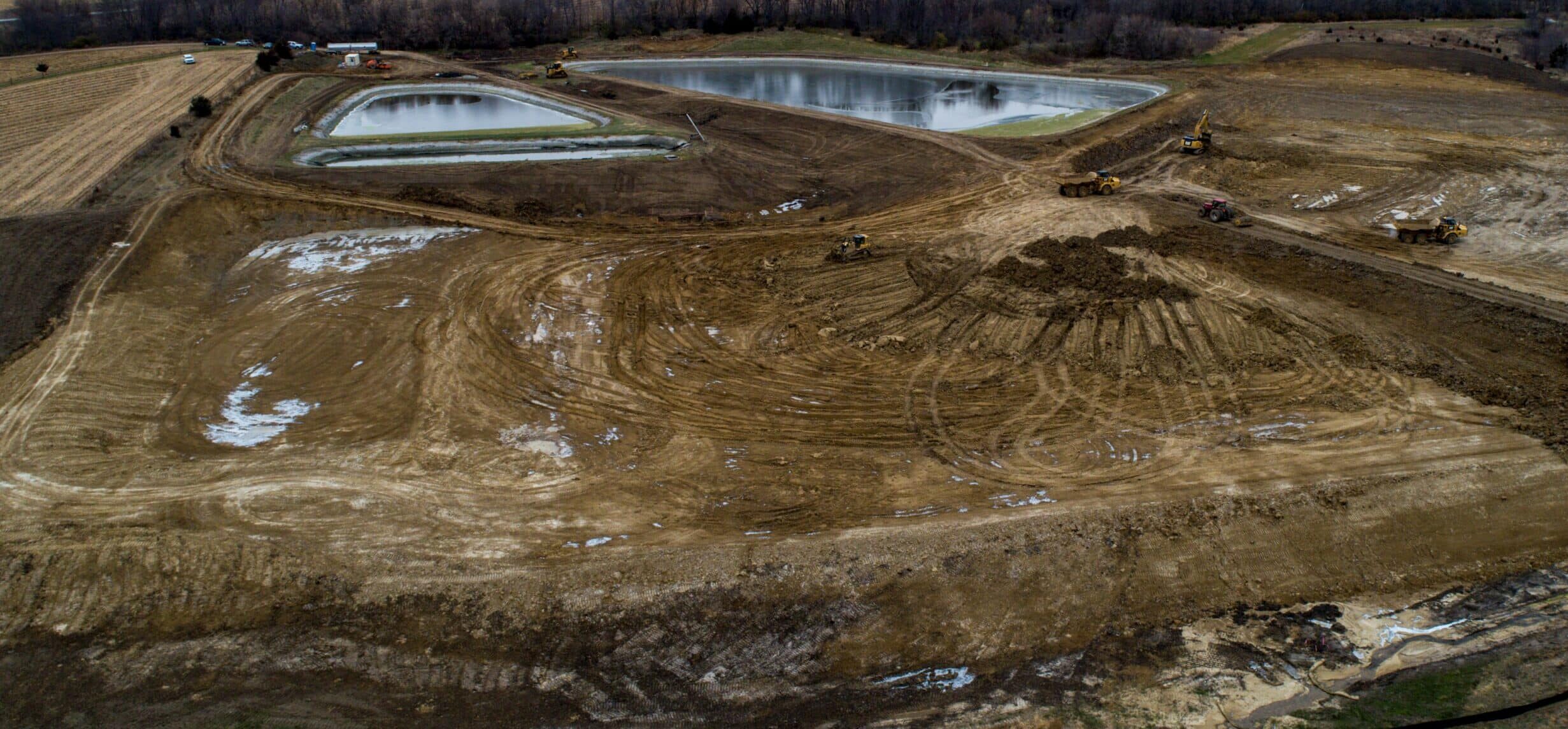
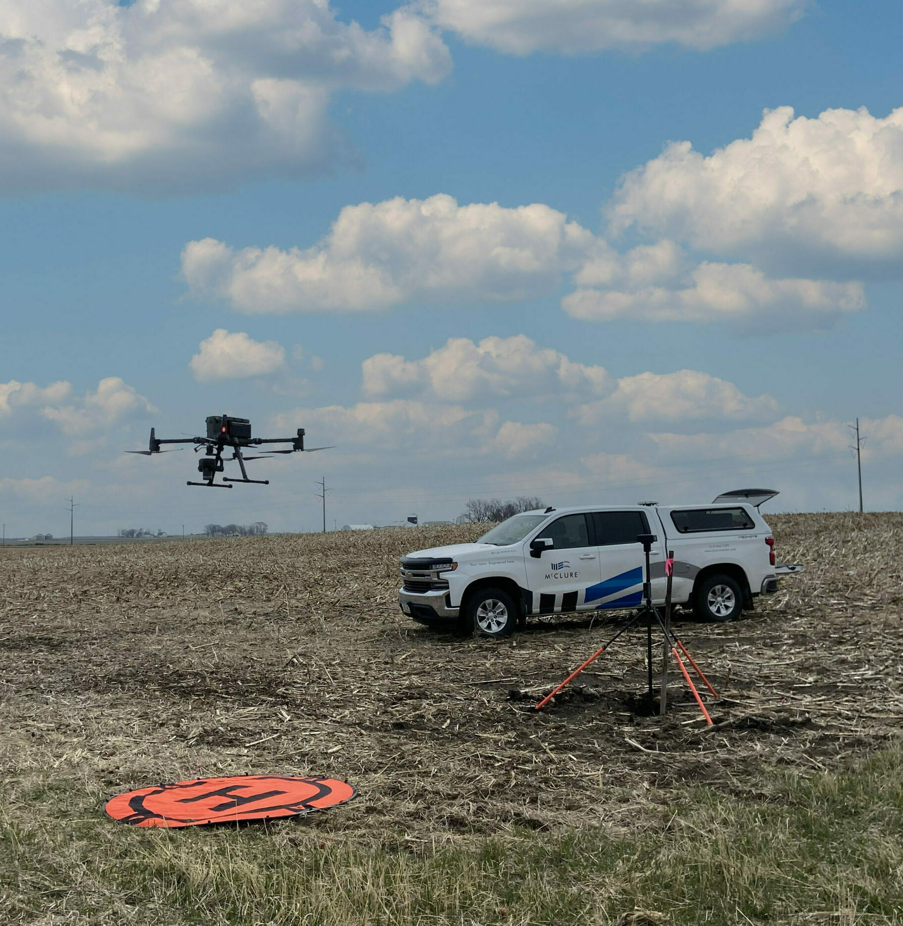
One of the most significant advancements in surveying technology is the use of drones. Drones equipped with high-resolution cameras and sensors can capture detailed images and data from above, providing a bird’s eye view of the land.
Drone surveying services offer a faster, more accurate, and cost-effective alternative to traditional surveying methods. They can cover large areas in a fraction of the time it would take a surveyor on foot, and the data collected is more precise.
Benefits of Drone Surveying
The use of drones in surveying offers numerous benefits, including:
- Time and Cost Savings: As mentioned earlier, drones can cover large areas quickly, reducing the time and labor required for traditional surveying methods. This results in significant cost savings for companies and clients.
- Improved Accuracy: Drones equipped with high-resolution cameras and sensors can capture detailed images and data, resulting in more accurate measurements and maps.
- Safety: Surveying often involves working in hazardous environments, such as construction sites or remote areas. Drones eliminate the need for surveyors to be physically present in these areas, reducing the risk of accidents and injuries.
- Versatility: Drones can access areas that are difficult or impossible for surveyors to reach, such as steep slopes, tall buildings, or bodies of water.
Drones in Civil Engineering
The use of drones in civil engineering has been steadily increasing in recent years. Engineers use drones for various tasks, including:
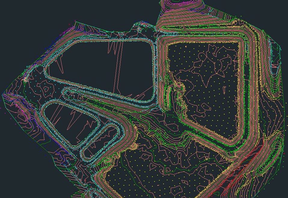
- Site Surveys: Drones can quickly and accurately map a construction site, providing engineers with valuable data for planning and design.
- Inspections: Drones equipped with thermal cameras and sensors can detect structural issues and defects that may not be visible to the naked eye. This allows engineers to identify and address potential problems before they become more significant and costly.
- Monitoring Construction Progress: Drones can capture images and videos of construction sites, providing engineers with a visual record of the progress and identifying any potential delays or issues.
- Environmental Assessments: Drones can be used to survey and monitor the impact of construction on the environment, such as erosion, vegetation, and wildlife.
The Future of Drone Surveying
The use of drones in surveying is still in its early stages, and there is much potential for growth and development in the future. Some of the advancements we can expect to see in the coming years include:
- Improved Sensors and Cameras: As technology continues to advance, we can expect to see more advanced sensors and cameras on drones, allowing for even more precise data collection.
- Autonomous Drones: Currently, drones require a pilot to operate them. However, in the future, we may see the development of autonomous drones that can fly and collect data without human intervention.
- Integration with Other Technologies: Drones can already be integrated with other technologies, such as GPS and LiDAR. In the future, we can expect to see even more integration with technologies like artificial intelligence and virtual reality.
Challenges and Considerations
While the use of drones in surveying offers numerous benefits, there are also some challenges and considerations to keep in mind.
- Regulations: The use of drones is regulated by aviation authorities in each country. It is essential to understand and comply with these regulations to avoid legal issues.
- Weather Conditions: Drones are susceptible to weather conditions such as strong winds, rain, and fog. It is crucial to consider weather conditions before conducting a drone survey to ensure the safety of the equipment and the accuracy of the data collected.
- Data Management: Drones can collect vast amounts of data, which can be overwhelming to manage. It is essential to have a system in place to organize and analyze the data effectively.
Conclusion
Drones have revolutionized the way McClure’s Survey team gathers data and maps the world around us. They offer numerous benefits, including time and cost savings, improved accuracy, and increased safety.
As technology continues to advance, we can expect to see even more applications for drones in surveying and civil engineering. By embracing this technology, we can improve efficiency, reduce costs, and create a safer and more sustainable world.

Josh Doughan
Josh serves as the Vice President of Survey where he manages the firm’s resources in providing survey services to both internal and external clients. McClure’s Survey team has crews located throughout the states of Iowa, Kansas, and Missouri, and provides a vast array of services ranging from legal surveys, high-definition 3D scanning, topographic surveys, detailed construction layout, and remote sensing. Josh brings over 20 years of surveying experience and has completed many successful projects of all sizes, ranging from residential site plans to multi-million dollar industrial and transportation sites. He has gained extensive experience working for large clients including the Iowa, Kansas, and Missouri Department of Transportation, the Federal Highway Administration, and U.S. Army Corps of Engineers, and dozens of General Contractors throughout the Midwest.
Learn More
Learn more about McClure’s Survey services or contact us at info@mcclurevision.com.


")


